

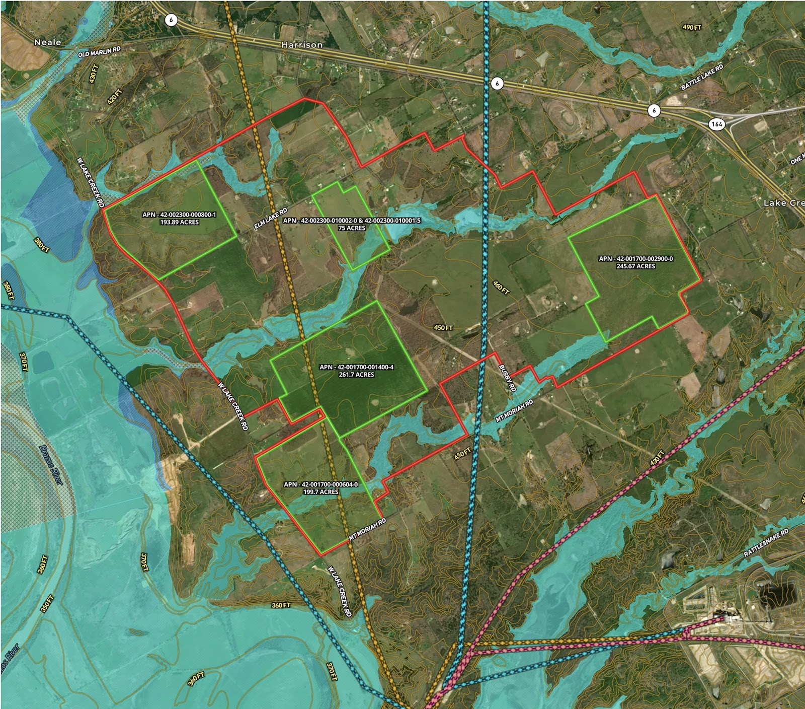
This custom site selection map was built to support the early-stage planning and due diligence for a proposed new school in rural Waco, Texas. With multiple factors influencing land suitability, the map visualizes key criteria to guide decision-makers through a complex evaluation process.
Key features include:
- A clearly defined selection boundary identifying the broader search area.
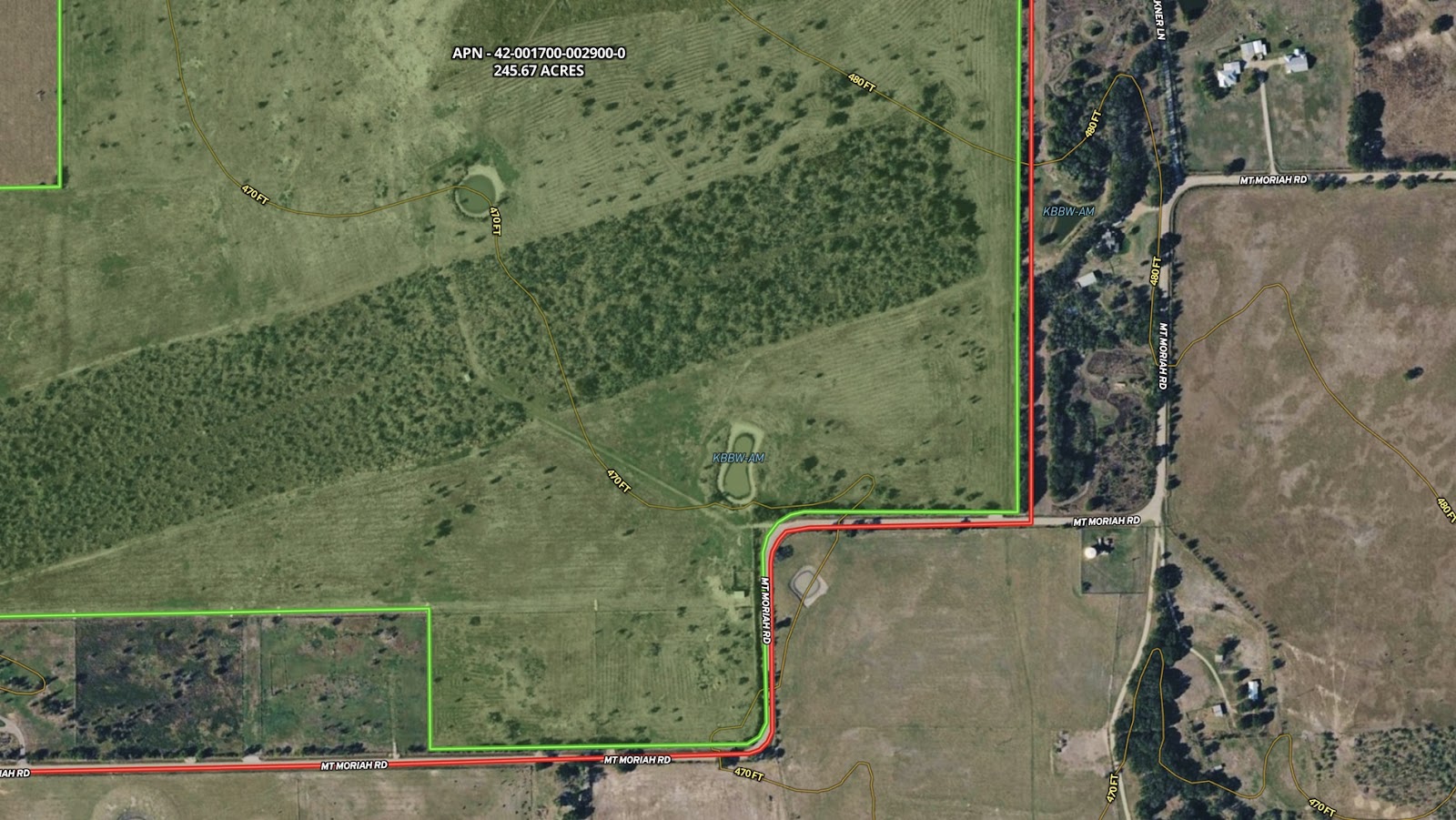
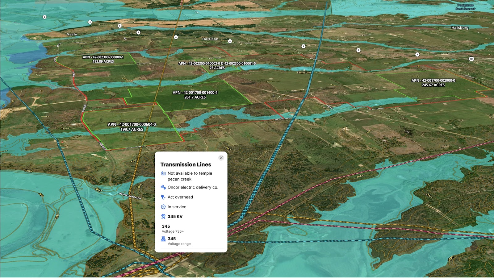
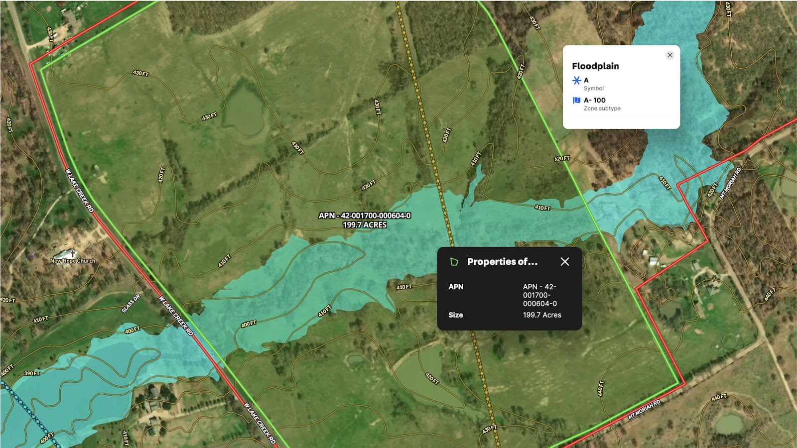
- Highlighted land parcels under consideration, each labeled with APN and acreage.
- Overlaid floodplain data to flag parcels with potential development constraints.
- Visible transmission lines to assess proximity to power infrastructure.
By integrating critical land, environmental, and utility data in one view, this Land id® map helps streamline the site selection process—making it easier to eliminate unsuitable parcels and focus on viable, build-ready options.
Learn How to Create a Map Like This:
- How to make maps in Land id
- Create and edit boundaries
- Add labels to maps and mapped items
- Measurement tools
- FEMA Floodplain Overlay
- Contour Lines Overlay
- Transmission Lines Overlay
More Map Examples
Keep Exploring


Real Estate
5.6 Acre Rural Listing in Bozeman, MT
Land id® GIS mapping software creates immersive real estate maps that showcase property features, land parcels, and lifestyle highlights for this Bozeman riverside retreat.

Real Estate
Commercial Real Estate Off-Market Prospecting
Boost your sales pipeline with Land id®'s real estate mapping software. Create property maps to track land parcels, market trends, and off-market opportunities with ease.

Real Estate
Subdivided Lots for Sale
Simplify how you subdivide a parcel of land with Land id's cut tool.

Real Estate
Data Center Development Site Analysis
Use Land id® GIS mapping software to evaluate land parcels for data centers. Create a property map with overlays for utilities, floodplains, and more using real estate maps.
Take Your Mapping to the Next Level
Mapping is just the beginning. Land id is the #1 tool for researching, discovering, and showcasing land, and we're here to help you make the most of it, every step of the way.

