

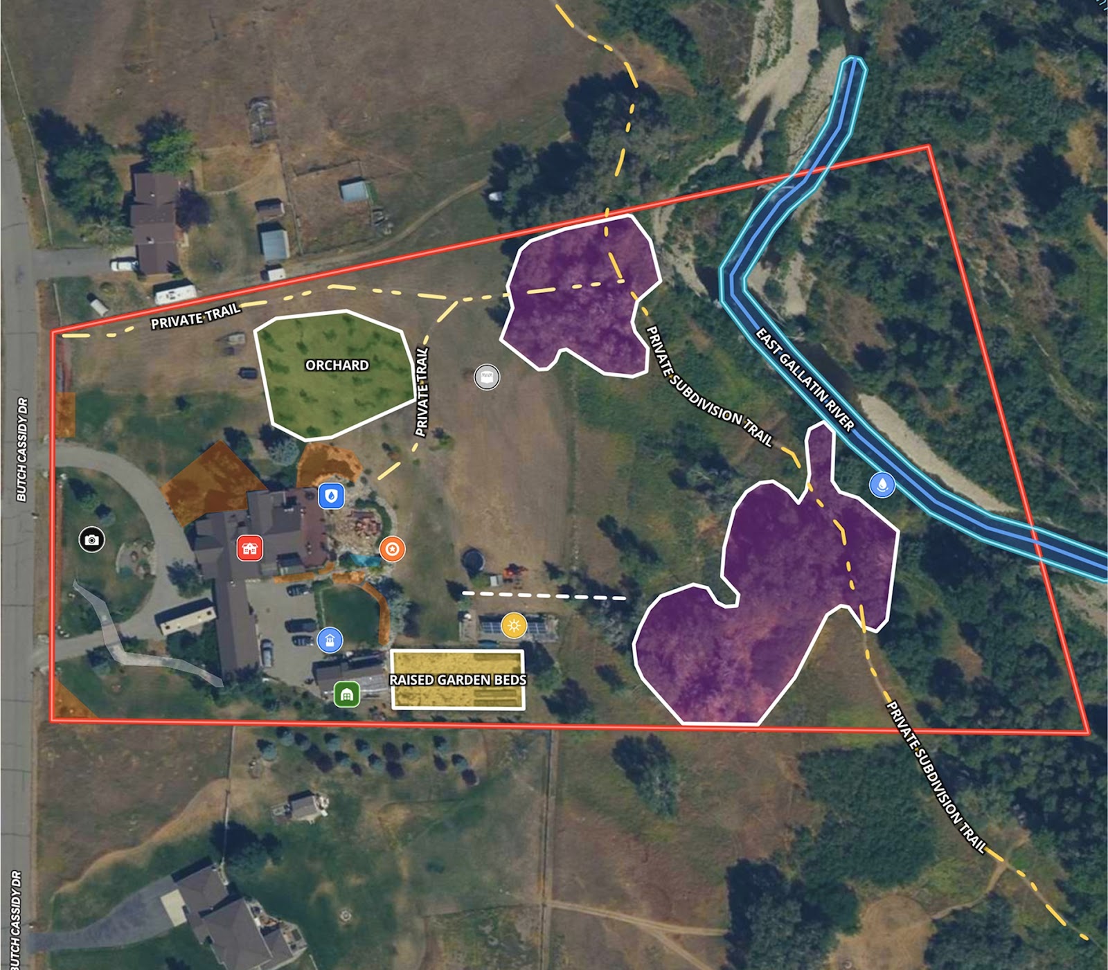
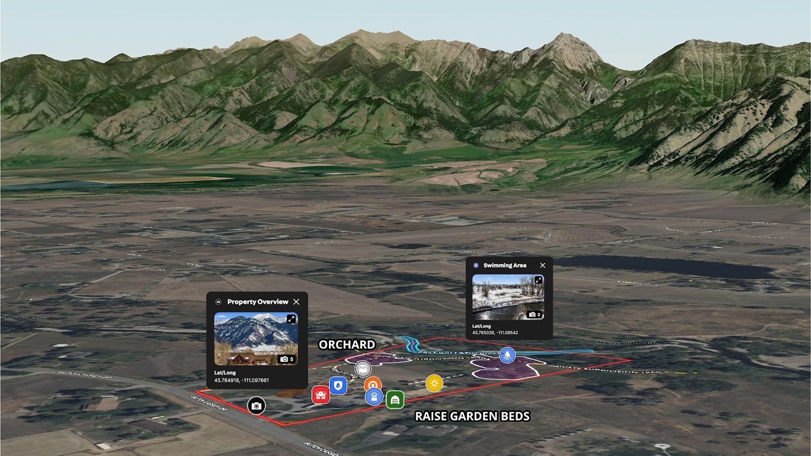
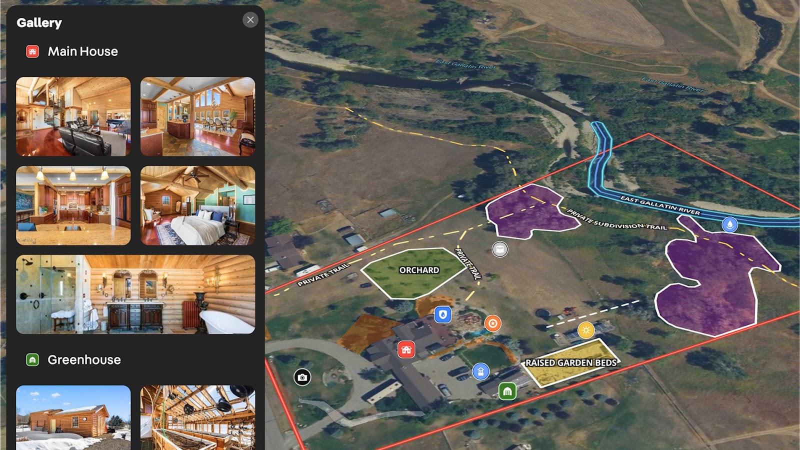
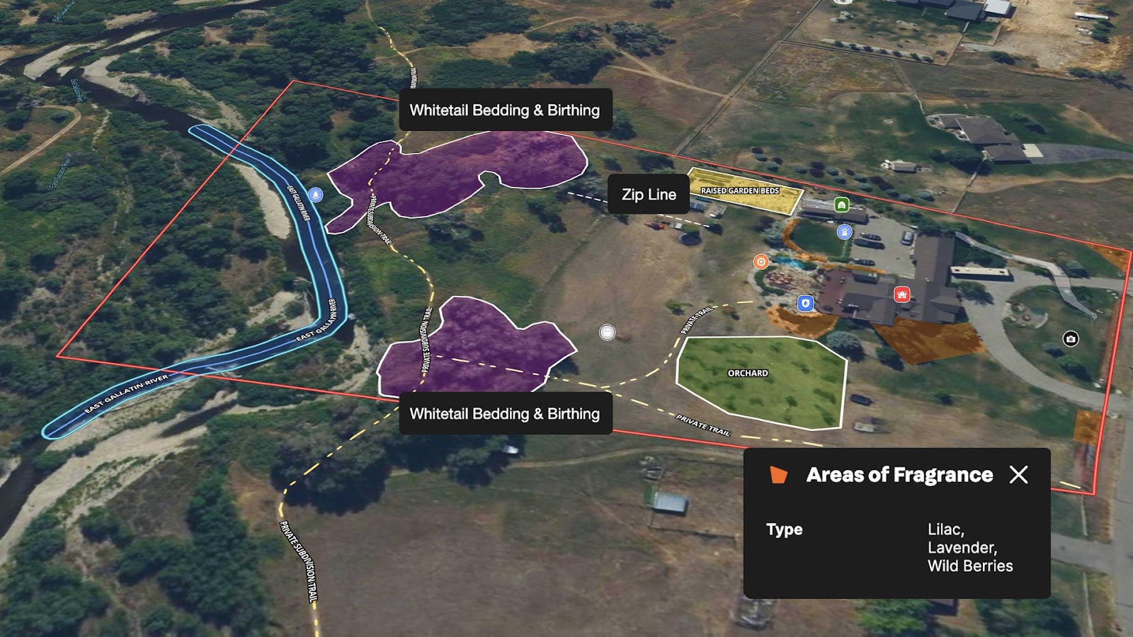
Nestled along the tranquil East Gallatin River in Bozeman, this extraordinary 4,800-square-foot log home captures the essence of Montana living. To complement the listing’s rich lifestyle narrative, a listing map was created to:
- Showcase the expansive outdoor living areas and access to trails and river access.
- Highlight eco-friendly and thoughtful upgrades from solar panels, garden beds, greenhouse, orchards, edible landscape, and even the underground dog fence.
- Orient buyers to the property’s proximity to Bozeman and the Bridger Mountains.
It’s more than a residence—it’s a riverside sanctuary built for sustainability, privacy, and year-round connection to nature.
With Land id®, high-end listings like this are elevated through immersive, detailed maps that help prospective buyers visualize their lifestyle—all before they ever set foot on the property.
Learn How to Create a Map Like This:
- How to make maps in Land id
- Draw detailed maps by adding items
- Add labels to maps and mapped items
- Embed photos, videos, 360° walkthroughs, and more onto your map
- Visualize maps in 3D
More Map Examples
Keep Exploring


Real Estate
Commercial Real Estate Off-Market Prospecting
Boost your sales pipeline with Land id®'s real estate mapping software. Create property maps to track land parcels, market trends, and off-market opportunities with ease.

Real Estate
Subdivided Lots for Sale
Simplify how you subdivide a parcel of land with Land id's cut tool.

Real Estate
Data Center Development Site Analysis
Use Land id® GIS mapping software to evaluate land parcels for data centers. Create a property map with overlays for utilities, floodplains, and more using real estate maps.
Real Estate
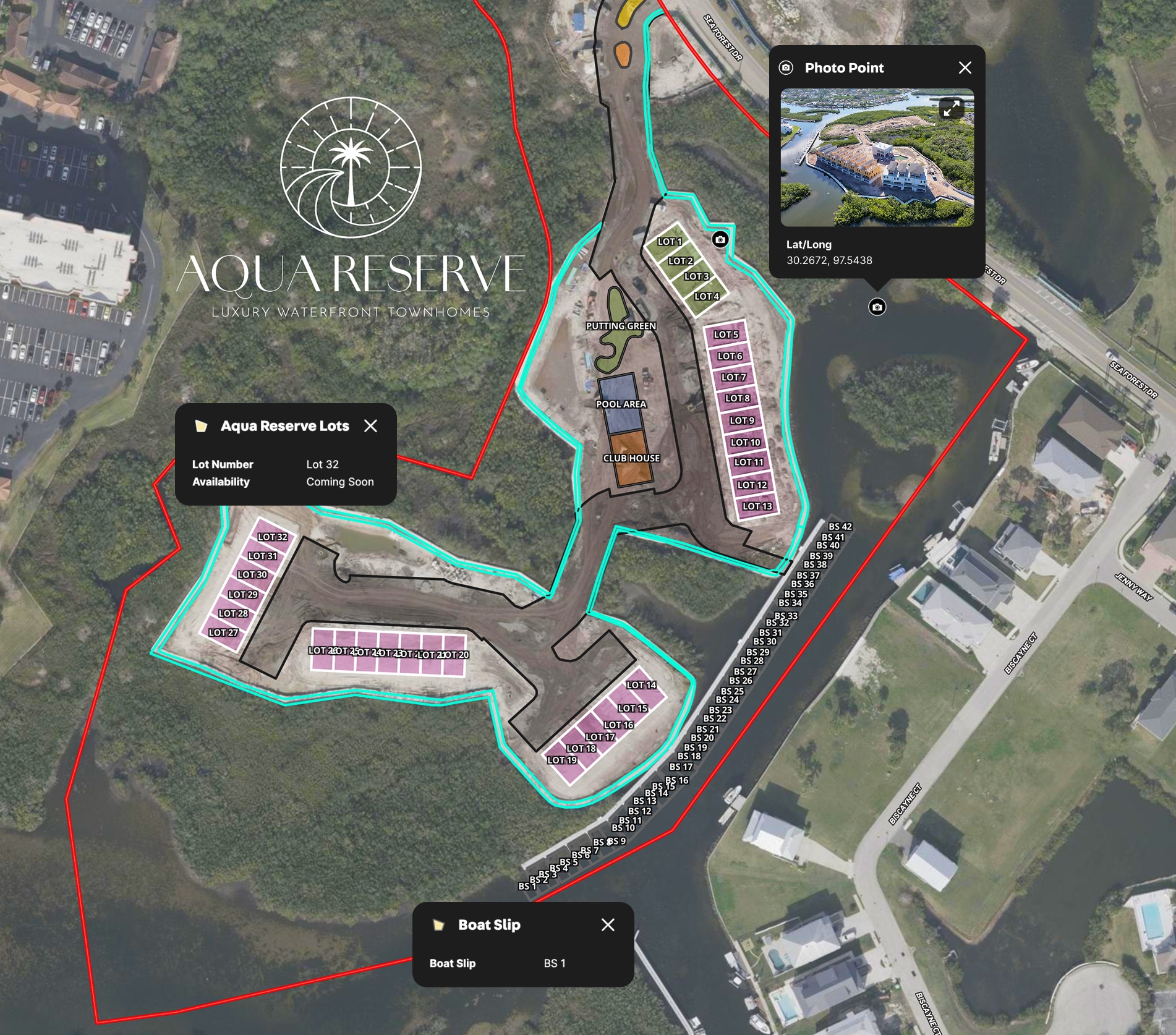
LPT Realty Aqua Reserve Development Map
LPT Realty used Land id® GIS mapping software to create a branded property map for new construction and show real-time availability insights.
Take Your Mapping to the Next Level
Mapping is just the beginning. Land id is the #1 tool for researching, discovering, and showcasing land, and we're here to help you make the most of it, every step of the way.

