
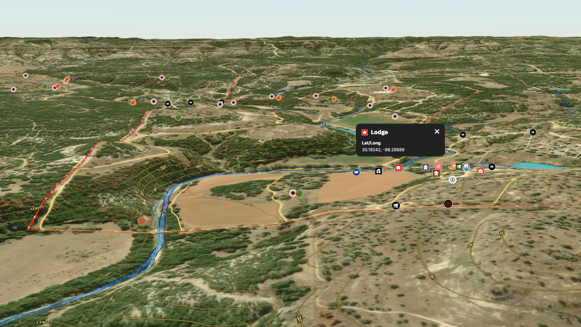
Landowners are passionate about their land and even more passionate about sharing it with their family and friends.
By using Land id®, this landowner created a interactive map to share with visitors and help them safely explore and enjoy his amazing ranch. This detailed map covers everything from different accommodations, ranch roads, fences, hunting blinds, and feeders.
Learn How to Create a Map Like This:


More Map Examples
Keep Exploring


Real Estate
5.6 Acre Rural Listing in Bozeman, MT
Land id® GIS mapping software creates immersive real estate maps that showcase property features, land parcels, and lifestyle highlights for this Bozeman riverside retreat.

Real Estate
Commercial Real Estate Off-Market Prospecting
Boost your sales pipeline with Land id®'s real estate mapping software. Create property maps to track land parcels, market trends, and off-market opportunities with ease.

Real Estate
Subdivided Lots for Sale
Simplify how you subdivide a parcel of land with Land id's cut tool.

Real Estate
Data Center Development Site Analysis
Use Land id® GIS mapping software to evaluate land parcels for data centers. Create a property map with overlays for utilities, floodplains, and more using real estate maps.
Take Your Mapping to the Next Level
Mapping is just the beginning. Land id is the #1 tool for researching, discovering, and showcasing land, and we're here to help you make the most of it, every step of the way.

