
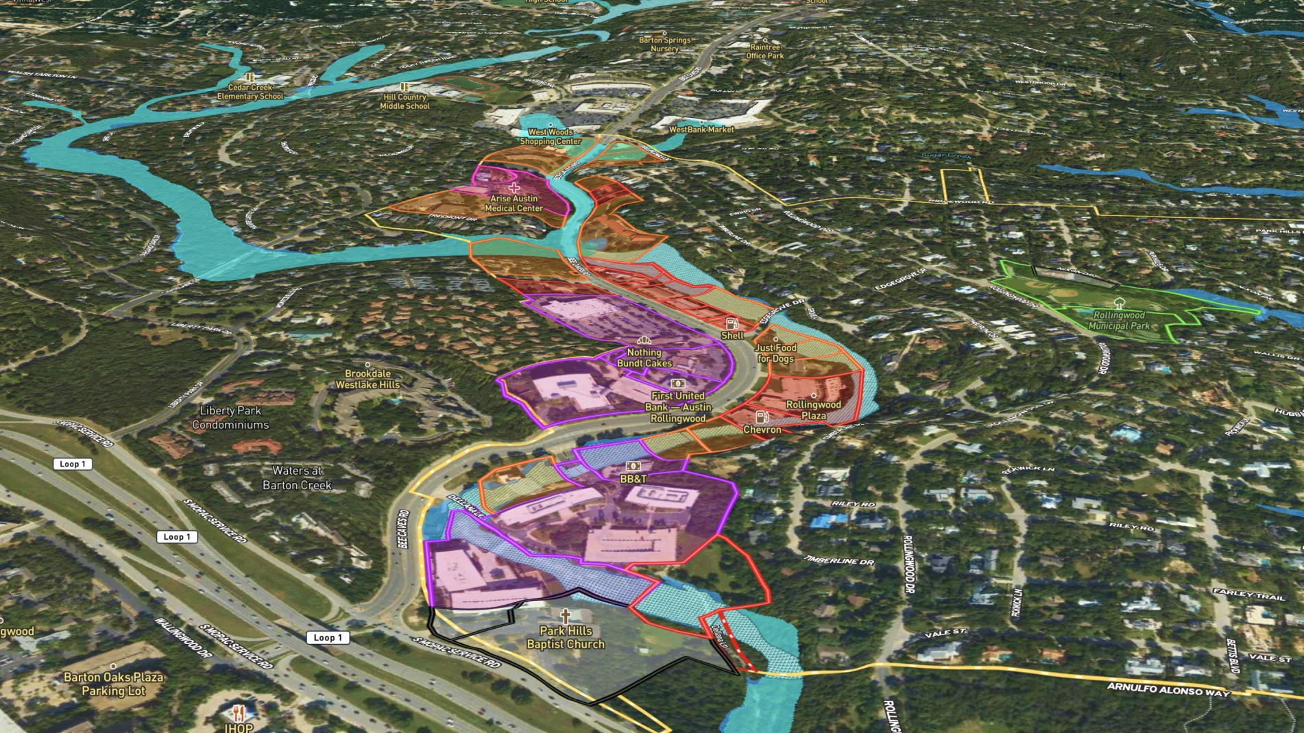
City office admins can create a city map and highlight government buildings, parks, and planned developments.
Then build and share maps specific to projects, like updating maintenance schedules or organizing events. When a property or project changes, it's easy to update the map to reflect the latest status.
Learn How to Make a Map Like This:
- How to make maps in Land id
- Draw detailed maps using the feature palette
- Divide a parcel of land in Land id
- Add labels to maps and mapped features


More Map Examples
Keep Exploring


Real Estate
5.6 Acre Rural Listing in Bozeman, MT
Land id® GIS mapping software creates immersive real estate maps that showcase property features, land parcels, and lifestyle highlights for this Bozeman riverside retreat.

Real Estate
Commercial Real Estate Off-Market Prospecting
Boost your sales pipeline with Land id®'s real estate mapping software. Create property maps to track land parcels, market trends, and off-market opportunities with ease.

Real Estate
Subdivided Lots for Sale
Simplify how you subdivide a parcel of land with Land id's cut tool.

Real Estate
Data Center Development Site Analysis
Use Land id® GIS mapping software to evaluate land parcels for data centers. Create a property map with overlays for utilities, floodplains, and more using real estate maps.
Take Your Mapping to the Next Level
Mapping is just the beginning. Land id is the #1 tool for researching, discovering, and showcasing land, and we're here to help you make the most of it, every step of the way.

