
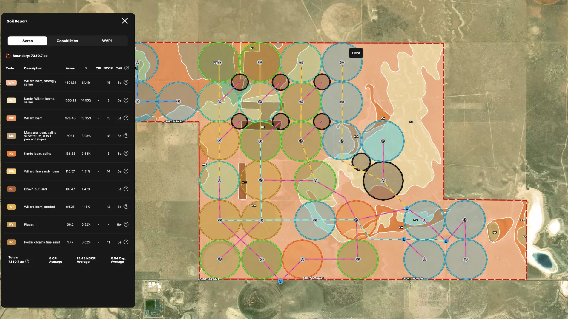
This land is a farmer's dream with its abundant water supply, irrigation infrastructure, acreage, tillable land, and an interactive map to streamline management.
Streamline your ag operations with Land id®:
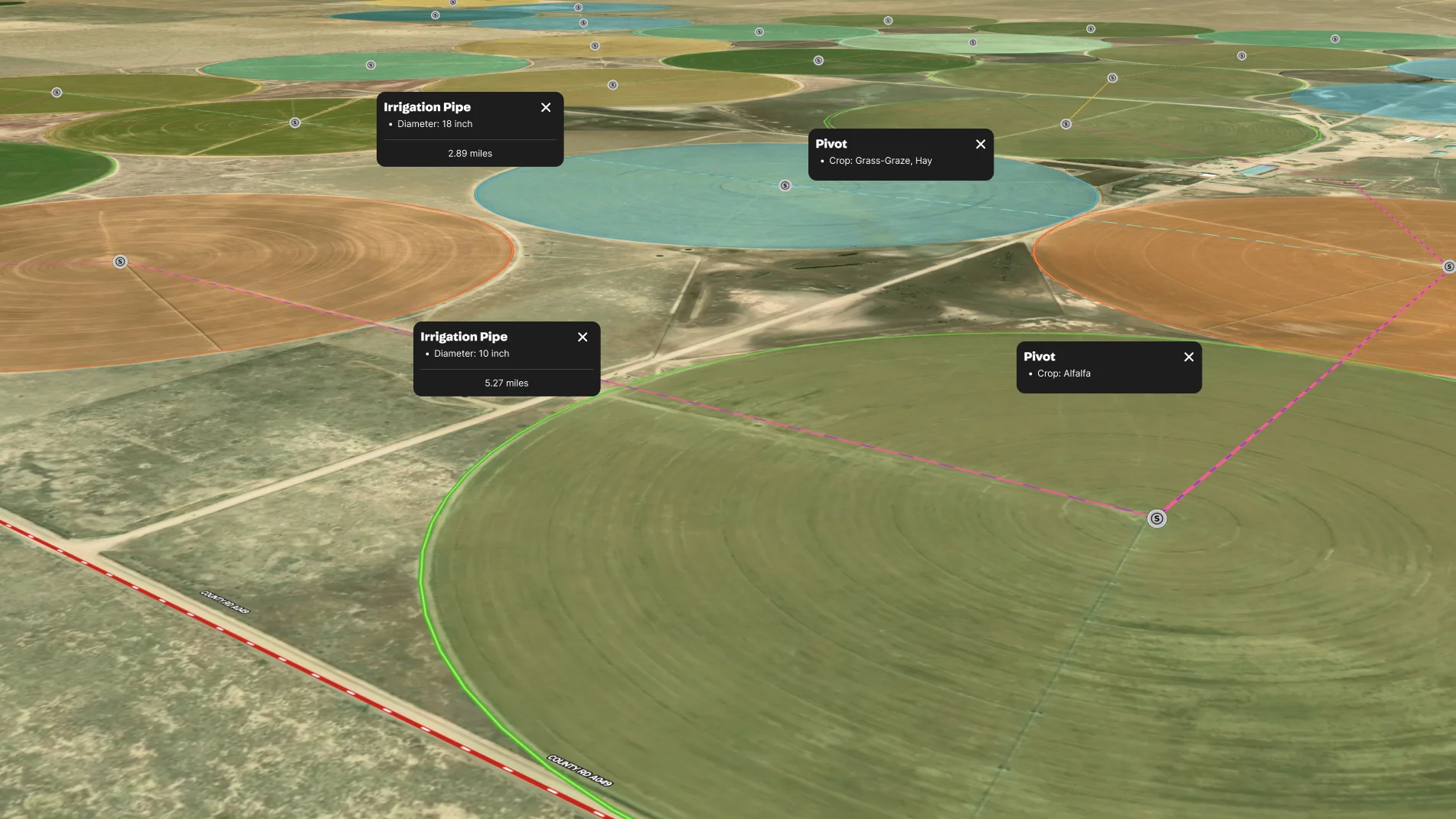
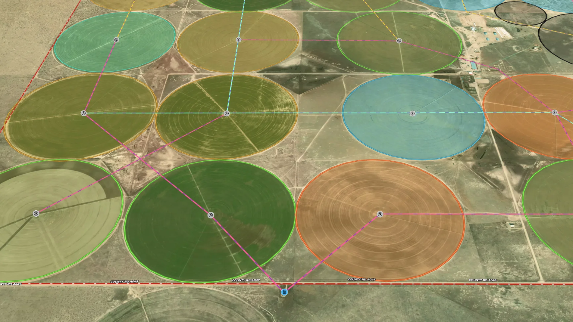
- Make an efficient irrigation plan with wells, center pivots, and pipeline to ensure you can move water as needed.
- Track the crops being grown in different fields and their specific soil testing requirements.
- Calculate how much seed and fertilizer you'll need for different crops.
- Market your crops by sharing a map and inviting your buyer to visit.
- Create a detailed crop history by creating a master map of your farm and then saving a copy for this year's crop plan.
Ditch your spreadsheets and adopt a visual, map-based approach to managing your ag land.
Learn How to Make a Map Like This:
- How to build maps in Land id
- Draw detailed maps using the feature palette
- Add labels to maps and mapped features

More Map Examples
Keep Exploring


Real Estate
5.6 Acre Rural Listing in Bozeman, MT
Land id® GIS mapping software creates immersive real estate maps that showcase property features, land parcels, and lifestyle highlights for this Bozeman riverside retreat.

Real Estate
Commercial Real Estate Off-Market Prospecting
Boost your sales pipeline with Land id®'s real estate mapping software. Create property maps to track land parcels, market trends, and off-market opportunities with ease.

Real Estate
Subdivided Lots for Sale
Simplify how you subdivide a parcel of land with Land id's cut tool.

Real Estate
Data Center Development Site Analysis
Use Land id® GIS mapping software to evaluate land parcels for data centers. Create a property map with overlays for utilities, floodplains, and more using real estate maps.
Take Your Mapping to the Next Level
Mapping is just the beginning. Land id is the #1 tool for researching, discovering, and showcasing land, and we're here to help you make the most of it, every step of the way.

