

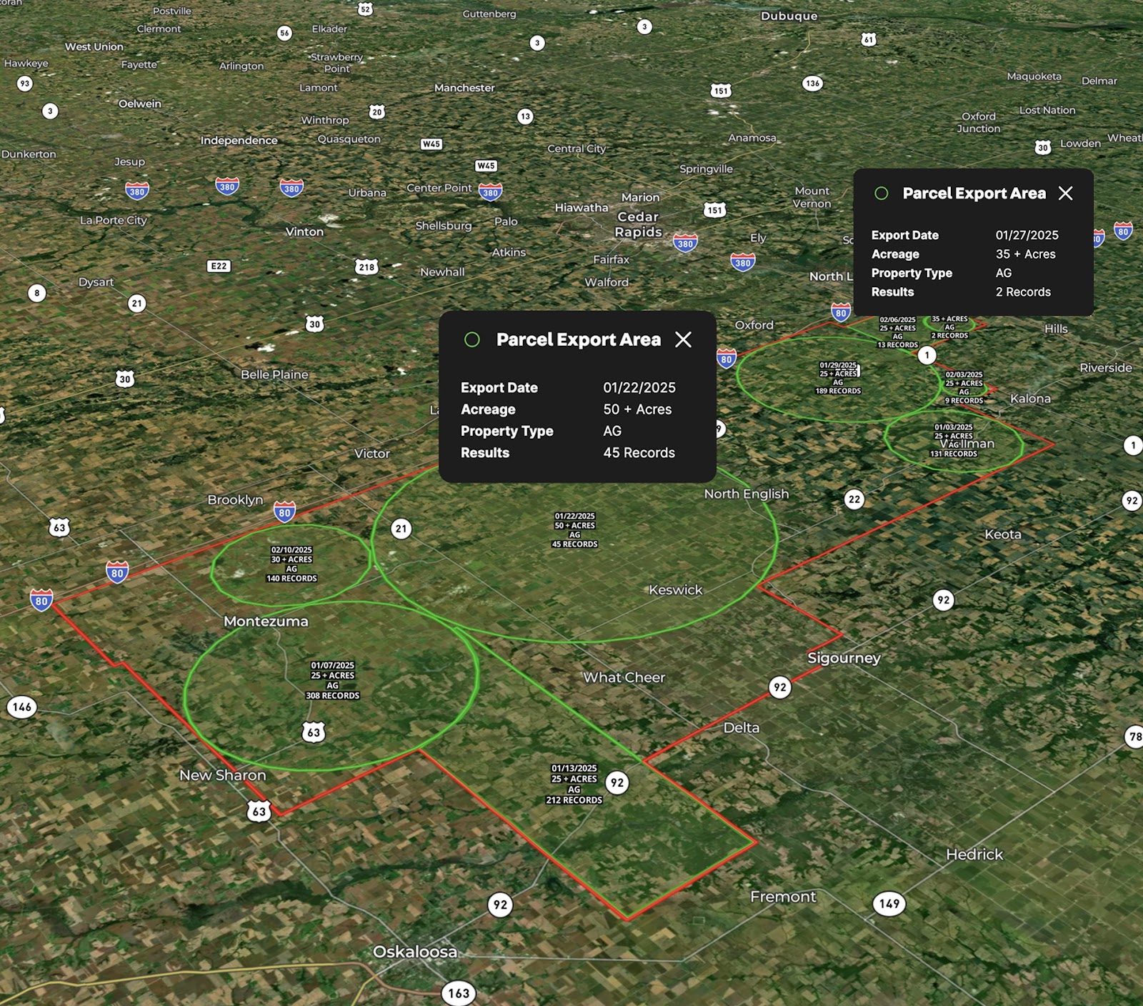
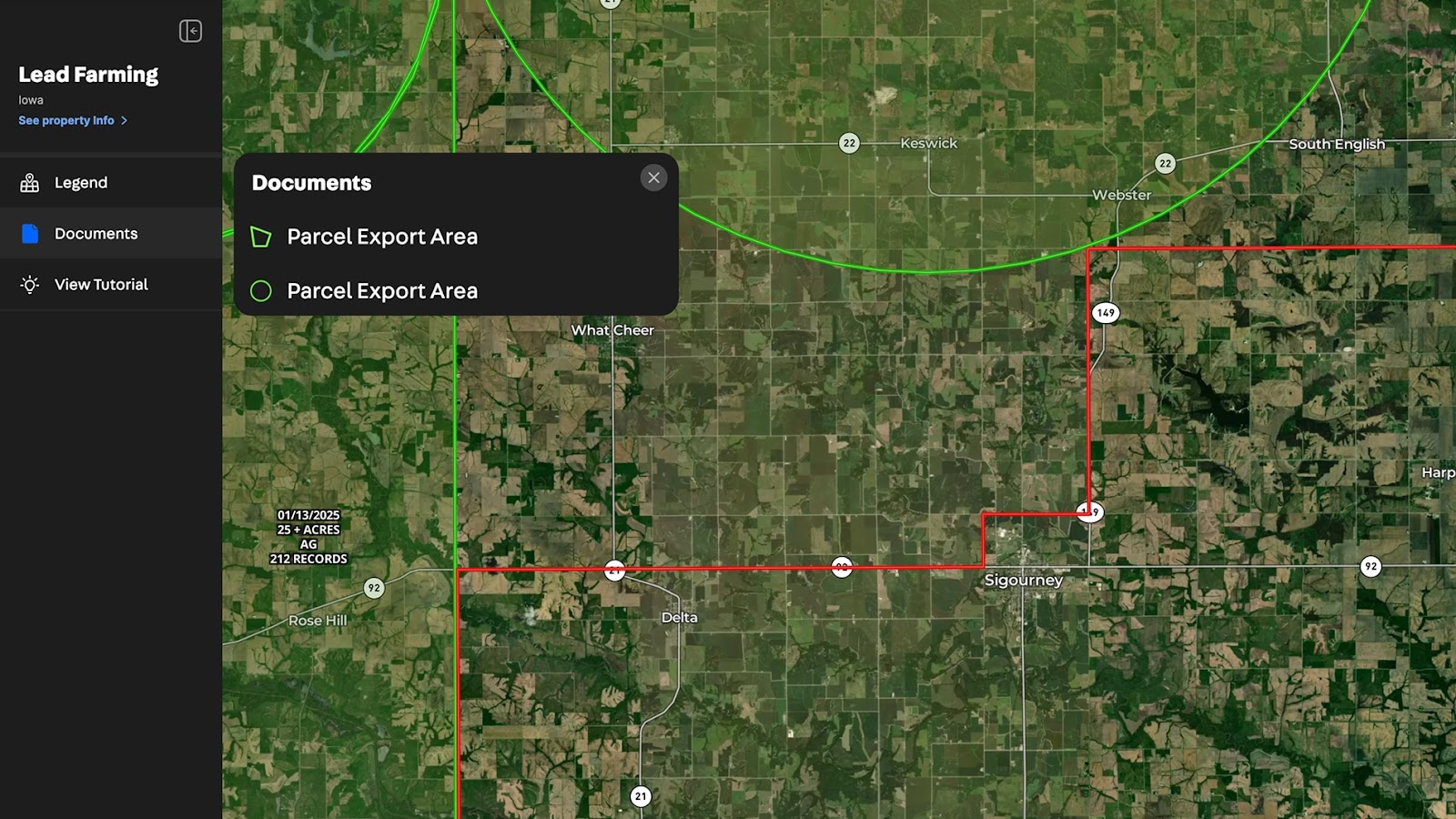
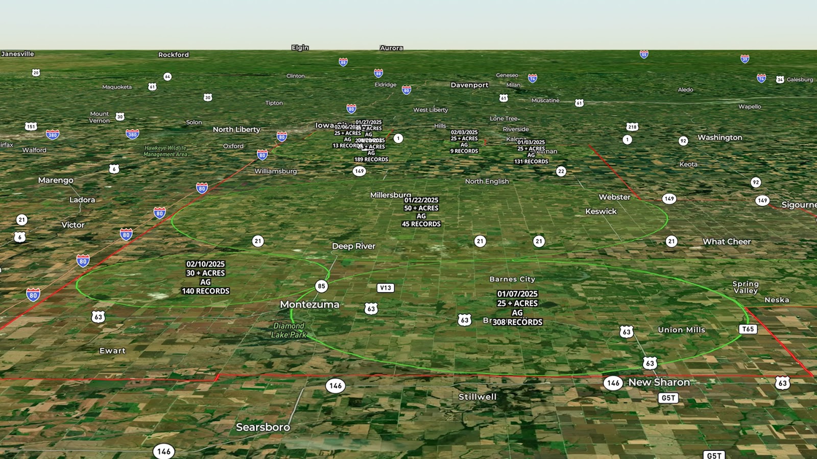
Maximize your prospecting efforts with Land id®'s interactive mapping tools. This example map highlights a defined target market area, showcasing specific regions where CSV property data was extracted. Each report area includes key details such as Export Date, Acreage Searched, Property Type, and the Number of Results.
Users can quickly revisit and analyze past data pulls, ensuring no area is overlooked. This map serves as a powerful tool for planning and tracking targeted mailing list campaigns, helping you optimize outreach efforts with precision.
Visualize your lead farming strategy and keep your marketing efforts organized with ease.
Learn How to Create a Map Like This:
- How to make maps in Land id
- Create a marketing or mailing list with owner list exports and custom owner mailing list requests
- Precision prospecting with Land id lists
- Draw detailed maps by adding items
- Add labels to maps and mapped items
- Manage and visualize data with Attributes
Keep Exploring


5.6 Acre Rural Listing in Bozeman, MT

Commercial Real Estate Off-Market Prospecting

Subdivided Lots for Sale

Data Center Development Site Analysis
Take Your Mapping to the Next Level
Mapping is just the beginning. Land id is the #1 tool for researching, discovering, and showcasing land, and we're here to help you make the most of it, every step of the way.

