
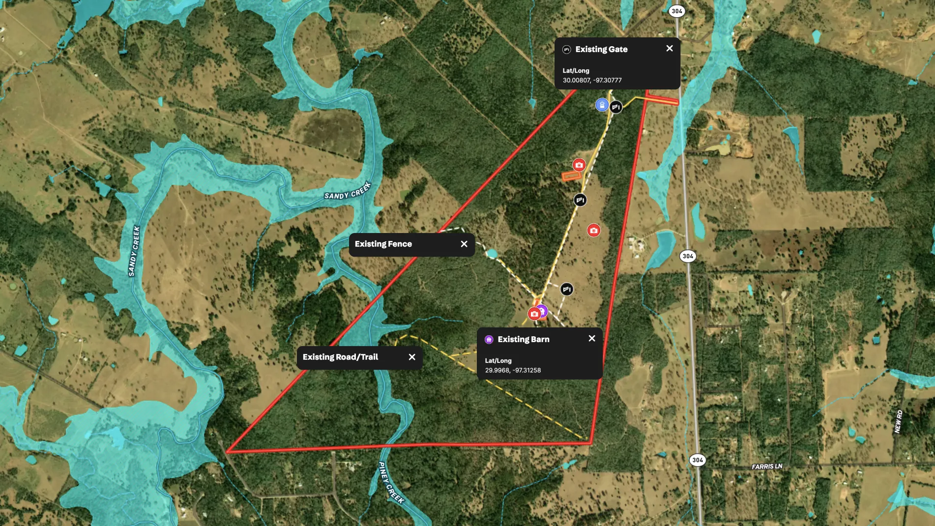
When land is placed into a trust, comprehensive baseline documentation maps play a pivotal role. These maps not only capture the property's existing conditions but also visualize development restrictions and showcase unique features. Such documentation is required for government approval before adding land into a trust, and once approved, these maps serve as ongoing references for guiding future land use, restoration, and easement compliance decisions.
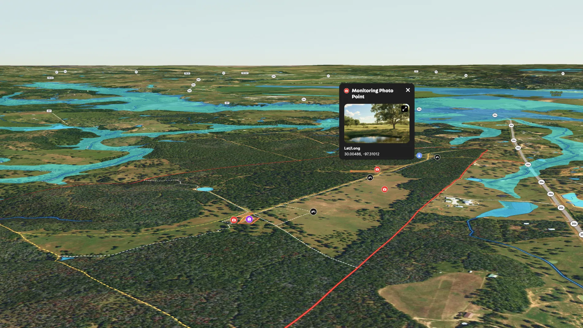
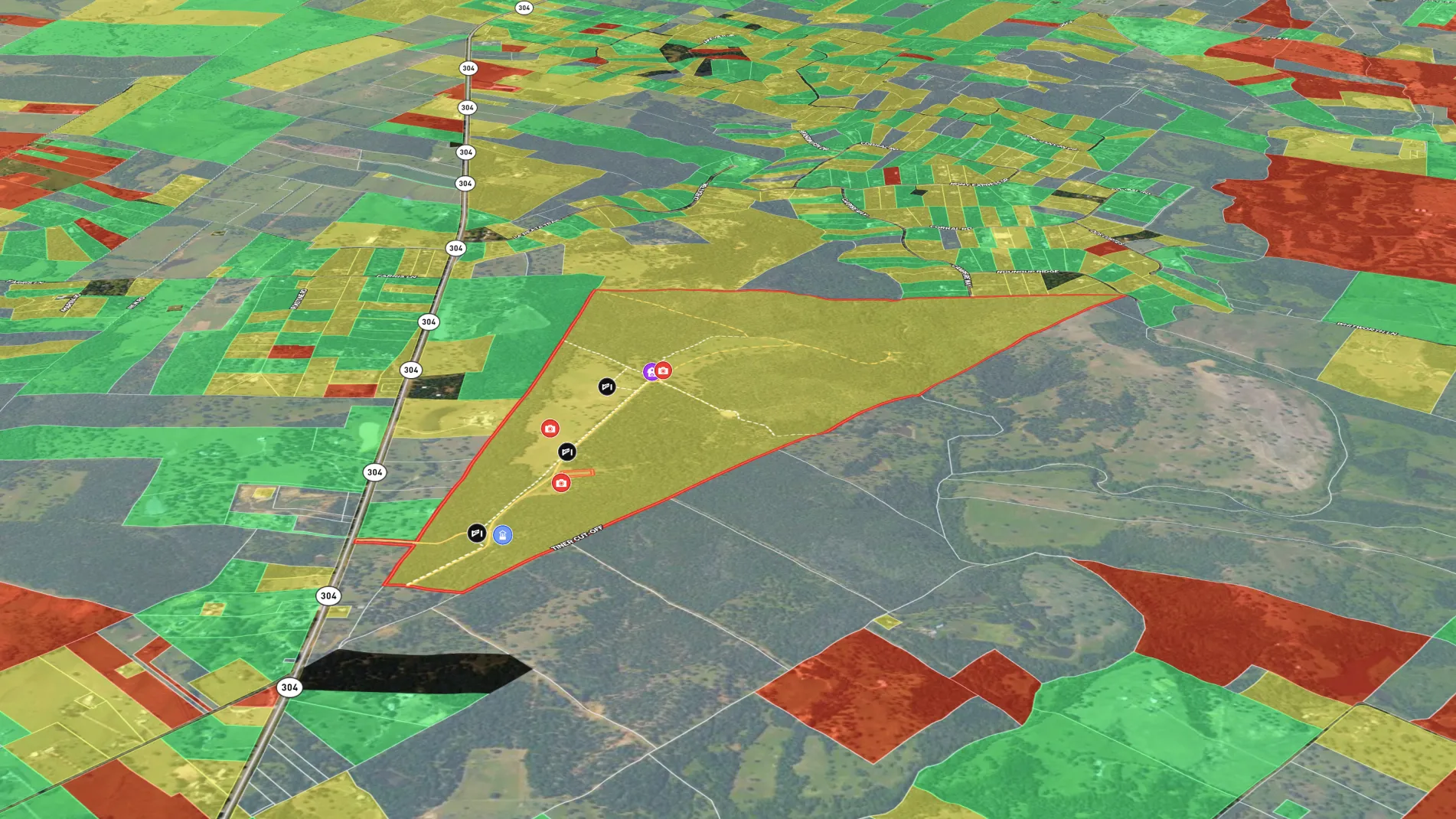
Land id® is revolutionizing this process for land trusts. Traditional mapping tools like ESRI can be overly complex and require a specialized GIS expert to create them in the office, rather than in the field where so much of the data exists. This slows down the process of getting baseline documentation maps. In the past, creating these maps took hours and required specialized expertise, but with Land id, conservation teams can create detailed maps in minutes, right in the field or back at the office. These maps can include existing infrastructure, building envelopes, natural resources and monitoring points. Conservation teams can easily print these maps for record-keeping or share them with stakeholders.
Users also appreciate Land id's mobile capabilities, which enable them to document site visits in real time, attach photos and notes, and instantly sync data between desktop and mobile devices. This functionality eliminates clunky, disjointed processes and ensures critical information is captured accurately and efficiently on-site. The ability to track changes to the land, add photo points, and generate detailed reports for land management is invaluable for land trust professionals.
By making professional-grade mapping accessible to anyone, Land id empowers conservation professionals to focus on what matters most—protecting and preserving valuable land resources.
Learn How to Make a Map Like This:
- How to make maps in Land id
- Draw detailed maps using the feature palette
- Embed photos, videos, 360° walkthroughs, and more onto your map
- Add labels to maps and mapped features
- Surface Water Overlay
Keep Exploring


5.6 Acre Rural Listing in Bozeman, MT

Commercial Real Estate Off-Market Prospecting

Subdivided Lots for Sale

Data Center Development Site Analysis
Take Your Mapping to the Next Level
Mapping is just the beginning. Land id is the #1 tool for researching, discovering, and showcasing land, and we're here to help you make the most of it, every step of the way.

