

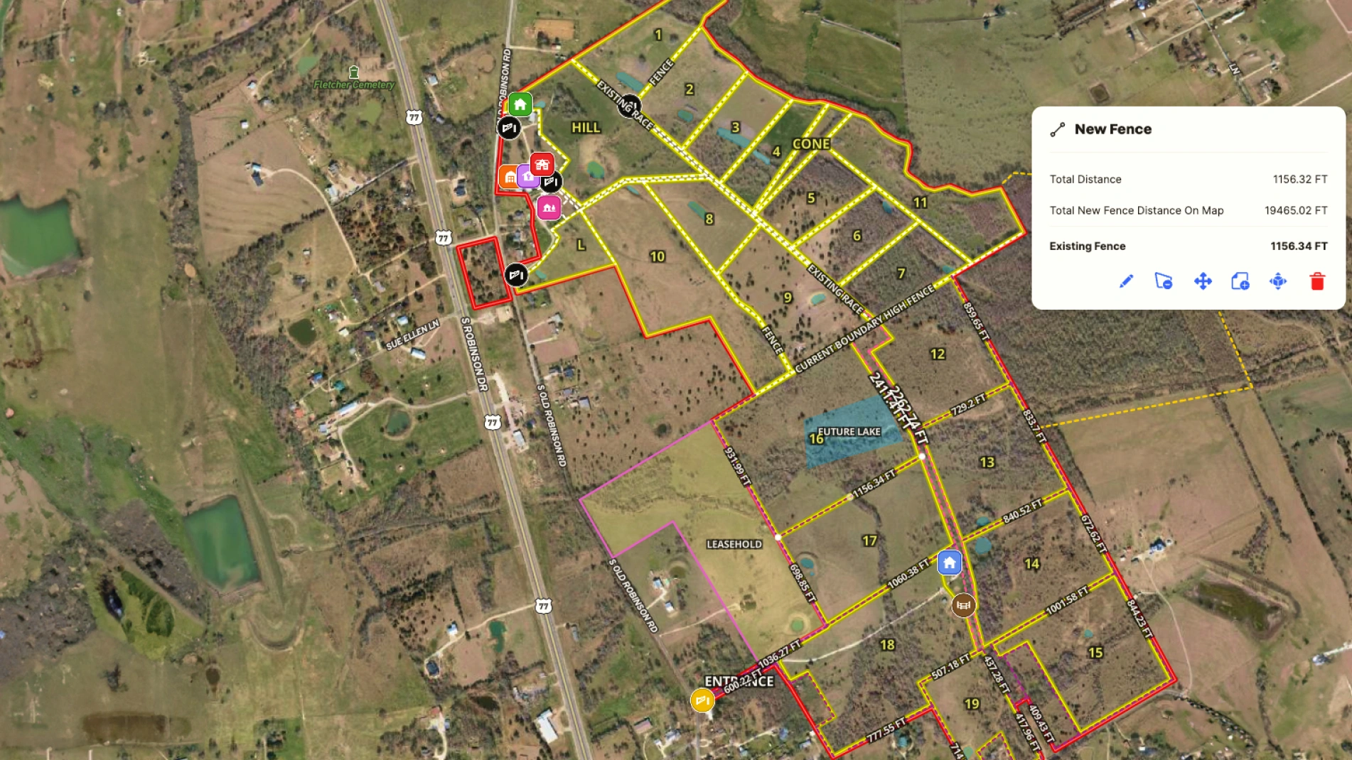
As a commercial real estate broker and developer with Triliji Group in Central Texas, Jimmy Banks knows land and specifically, Texas land. One of his favorite pieces of land is his personal ranch, where they specialize in improved genetic red deer. Jimmy uses Land id to map his red deer ranch and help planned infrastructure improvements.
Recently, he had the opportunity to expand his ranch by acquiring the southern section. As part of integrating this new southern section into the ranch, he wanted needed a way to accurately determine fence measurements and describe his vision to his contractors.
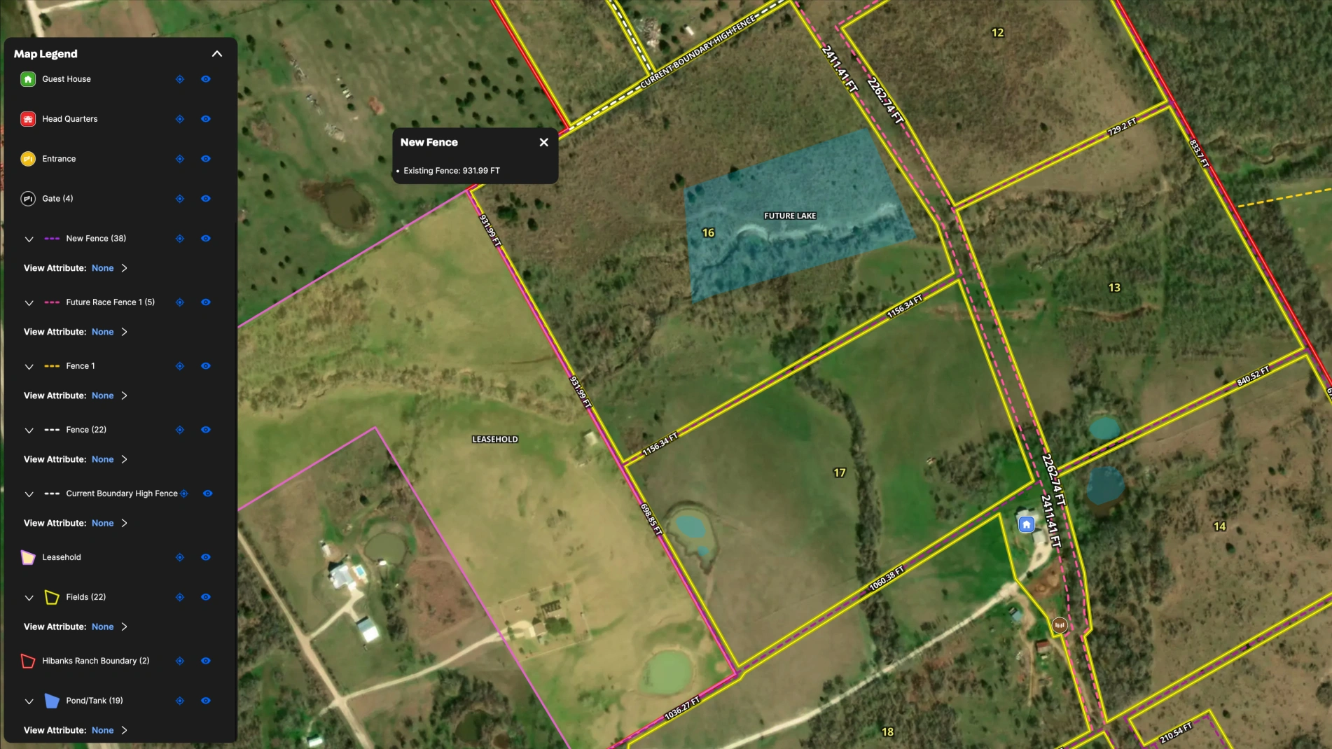
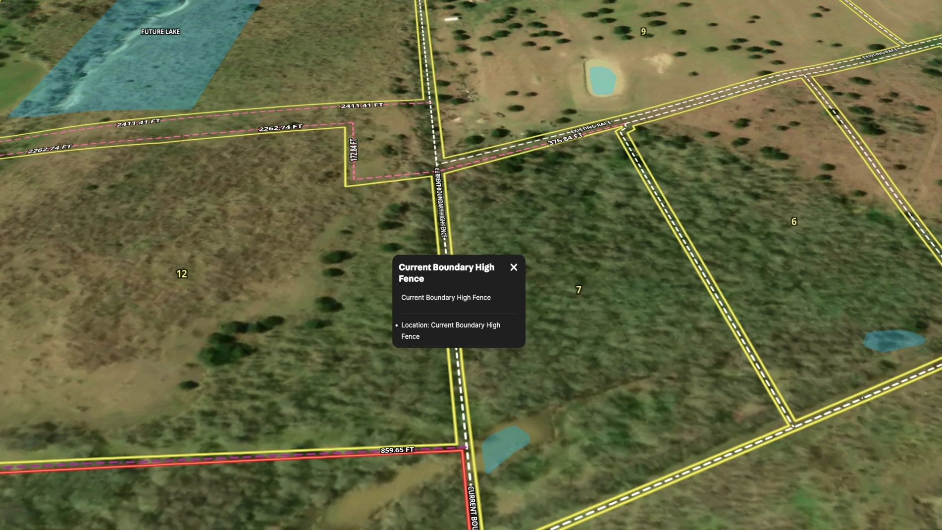
Jimmy leveraged Land id mapping services to document his ranch and outline the new fencing project. By using the distance and measurement tool, the Land id team was able to easily calculate the distances for the different sections of new fence and add them into the map.
Learn How to Create a Map Like This:
- How to make maps in Land id
- Draw detailed maps using the Feature Palette
- Add labels to maps and mapped features
- Measurement tool
- Land id mapping services

Make Your First Map in 3 Min.
Try for freeKeep Exploring


5.6 Acre Rural Listing in Bozeman, MT

Commercial Real Estate Off-Market Prospecting

Subdivided Lots for Sale

Data Center Development Site Analysis
Take Your Mapping to the Next Level
Mapping is just the beginning. Land id is the #1 tool for researching, discovering, and showcasing land, and we're here to help you make the most of it, every step of the way.

