
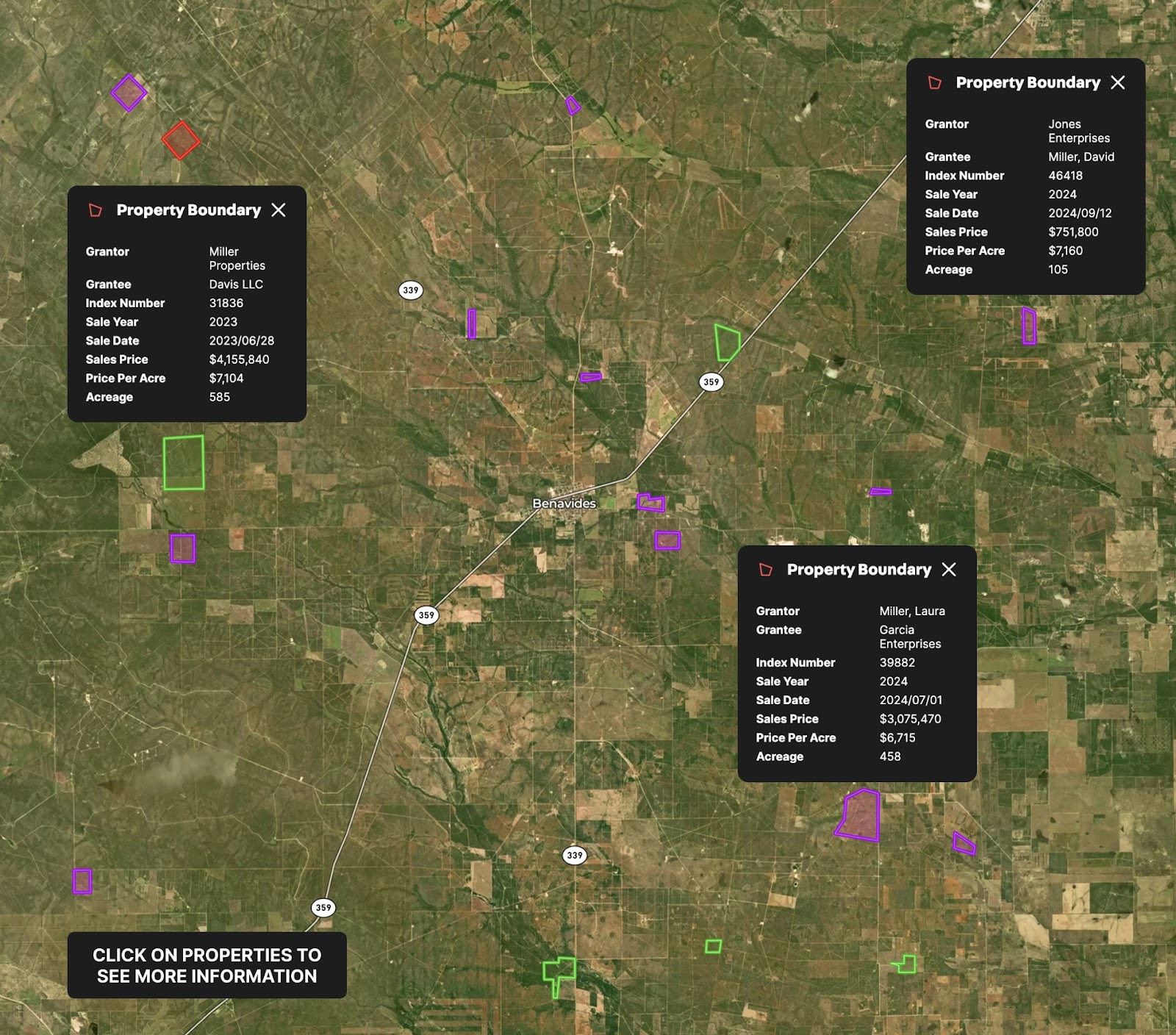
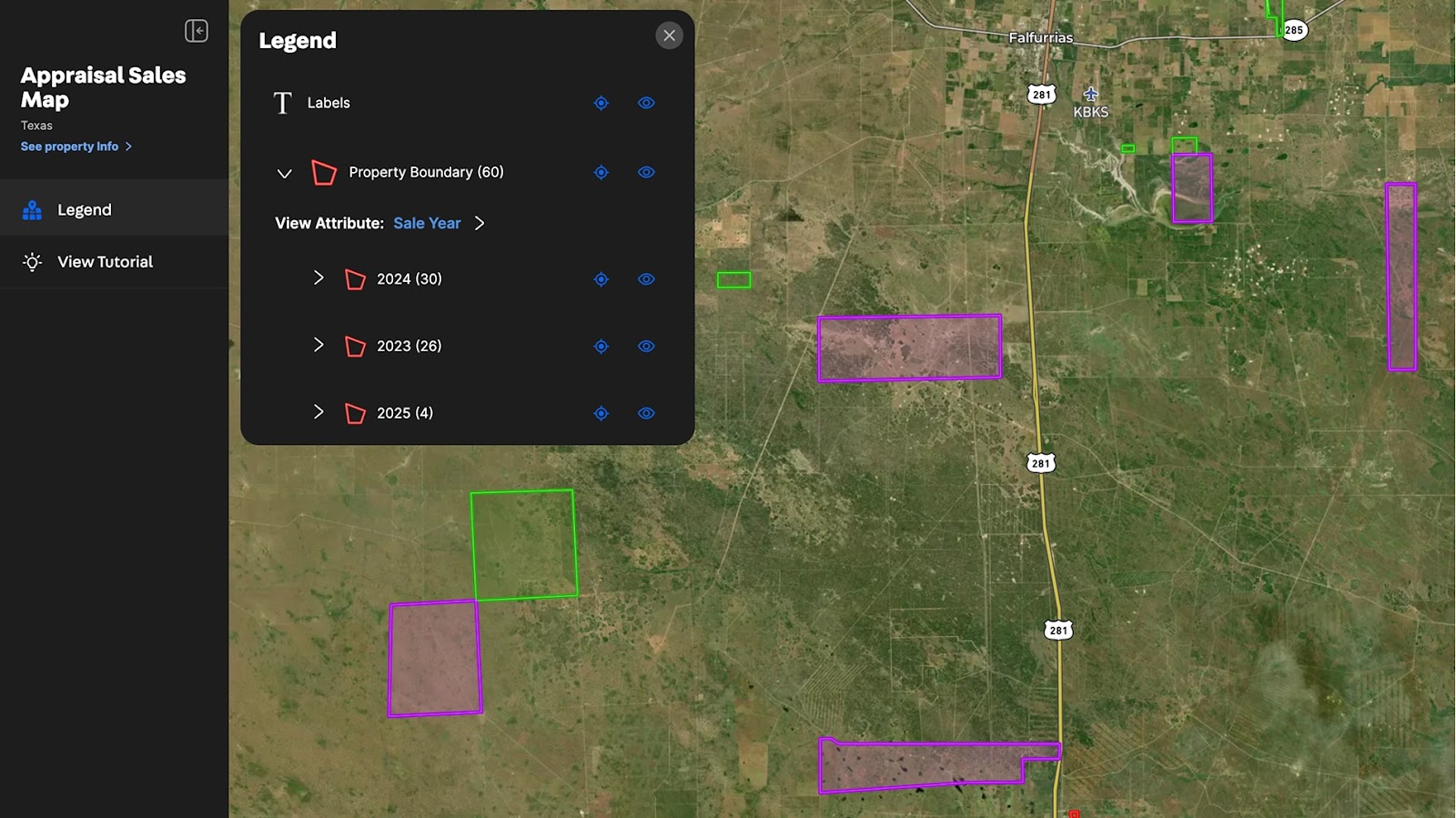
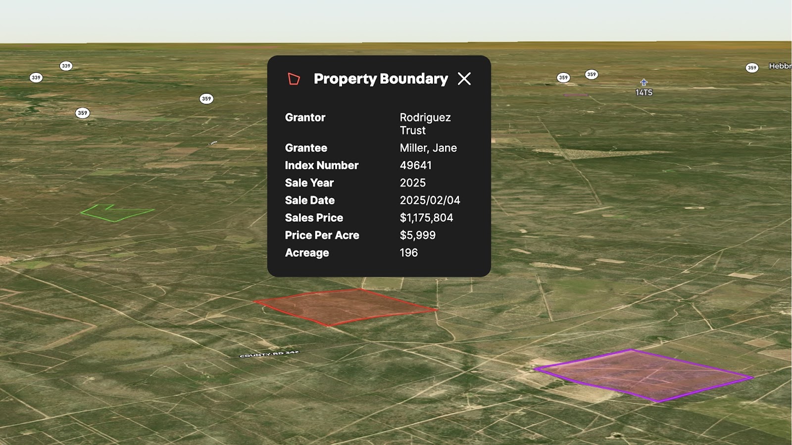
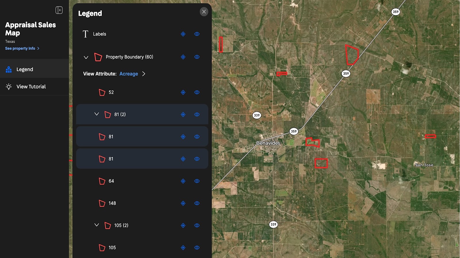
Leverage the power of Land id® to streamline your property appraisal process. This example map showcases 60 sold land tracts, complete with key transaction details such as Grantor, Grantee, Index Number, Sale Year, Sale Date, Sale Price, Price Per Acre, and Acreage.
With Land id, you can map multiple parcels, analyze sales data, and utilize interactive attributes to reveal market trends and insights at a glance. Easily filter and visualize properties by sale price, acreage, or other key metrics to make data-driven decisions with confidence.
See how appraisal mapping can enhance your workflow and provide a clear market overview.
Learn How to Create a Map Like This:
- How to make maps in Land id
- Draw detailed maps by adding items
- Add labels to maps and mapped items
- Manage and visualize data with Attributes
Keep Exploring


5.6 Acre Rural Listing in Bozeman, MT

Commercial Real Estate Off-Market Prospecting

Subdivided Lots for Sale

Data Center Development Site Analysis
Take Your Mapping to the Next Level
Mapping is just the beginning. Land id is the #1 tool for researching, discovering, and showcasing land, and we're here to help you make the most of it, every step of the way.

