
Make your listing stand out by making a better map.
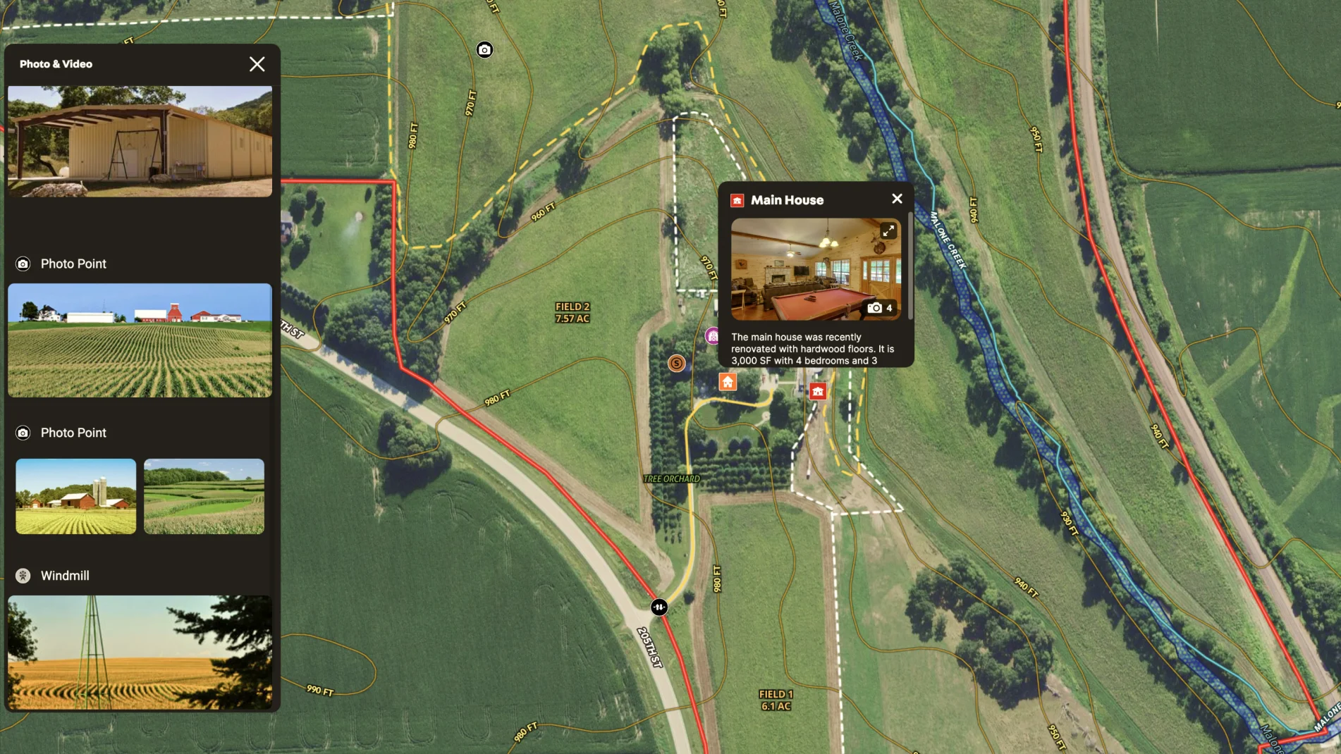
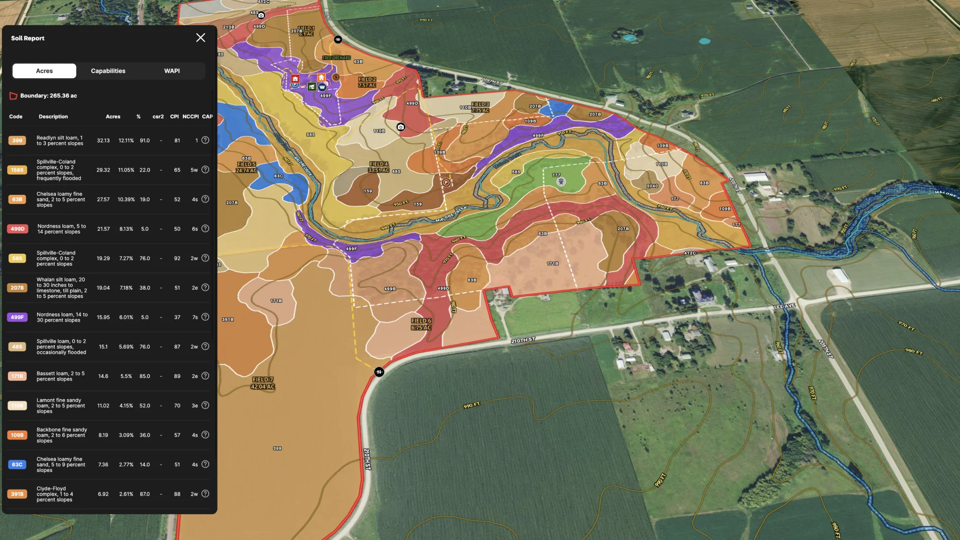
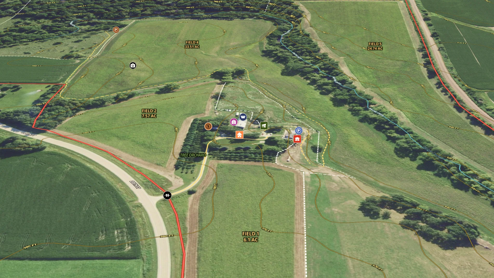
In this agricultural listing map, the agent helped prospective buyers understand the property by translating listing details onto a map. He included fields, acreage, water features, and terrain onto the map. Then he enabled them to experience what it's like to be onsite with embedded photos, videos, and a Matterport. He even helped prospective buyers to dig into the dirt with the soil report.
Learn How to Make a Map Like This:
- How to make maps in Land id
- Draw detailed maps using the feature palette
- Add labels to maps and mapped features
- Embed photos, videos, 360° walkthroughs, and more onto your map
- Add videos and documents to Land id shared maps
- Surface Water Overlay

More Map Examples
Keep Exploring


Real Estate
5.6 Acre Rural Listing in Bozeman, MT
Land id® GIS mapping software creates immersive real estate maps that showcase property features, land parcels, and lifestyle highlights for this Bozeman riverside retreat.

Real Estate
Commercial Real Estate Off-Market Prospecting
Boost your sales pipeline with Land id®'s real estate mapping software. Create property maps to track land parcels, market trends, and off-market opportunities with ease.

Real Estate
Subdivided Lots for Sale
Simplify how you subdivide a parcel of land with Land id's cut tool.

Real Estate
Data Center Development Site Analysis
Use Land id® GIS mapping software to evaluate land parcels for data centers. Create a property map with overlays for utilities, floodplains, and more using real estate maps.
Take Your Mapping to the Next Level
Mapping is just the beginning. Land id is the #1 tool for researching, discovering, and showcasing land, and we're here to help you make the most of it, every step of the way.

