

Todd Peterson of ToddsFotos.com specializes in capturing standout imagery for real estate, agricultural, and commercial properties. His website serves as a comprehensive listing "toolbox" for agents—housing everything from high-quality photos and marketing materials to maps and production records—all in one place.
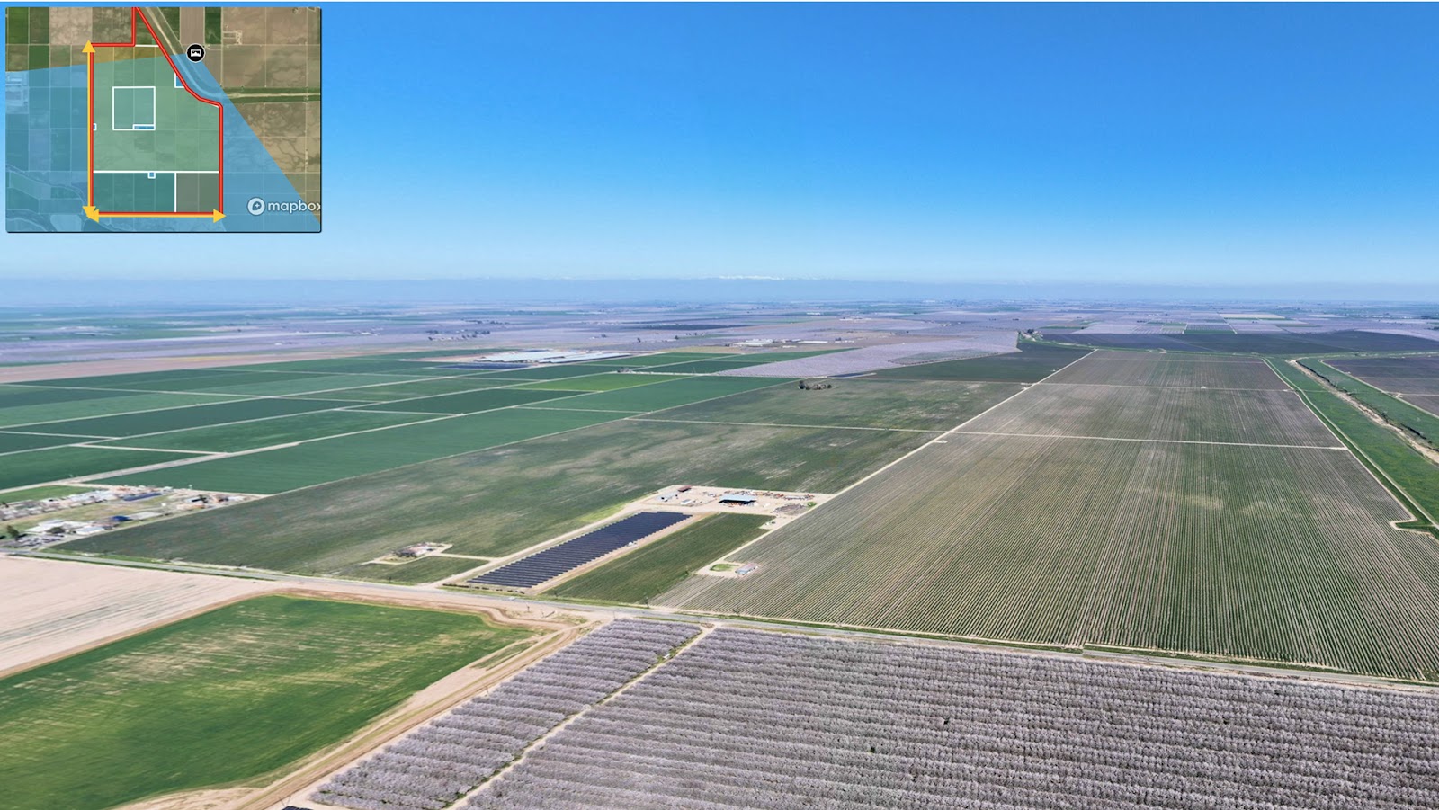
To elevate these listings further, Todd integrates interactive Land id® maps directly into his site, providing agents with a powerful, visual storytelling tool. These embedded maps help buyers quickly understand the property’s layout, land use, and unique features—something Todd has found to be a great differentiator.
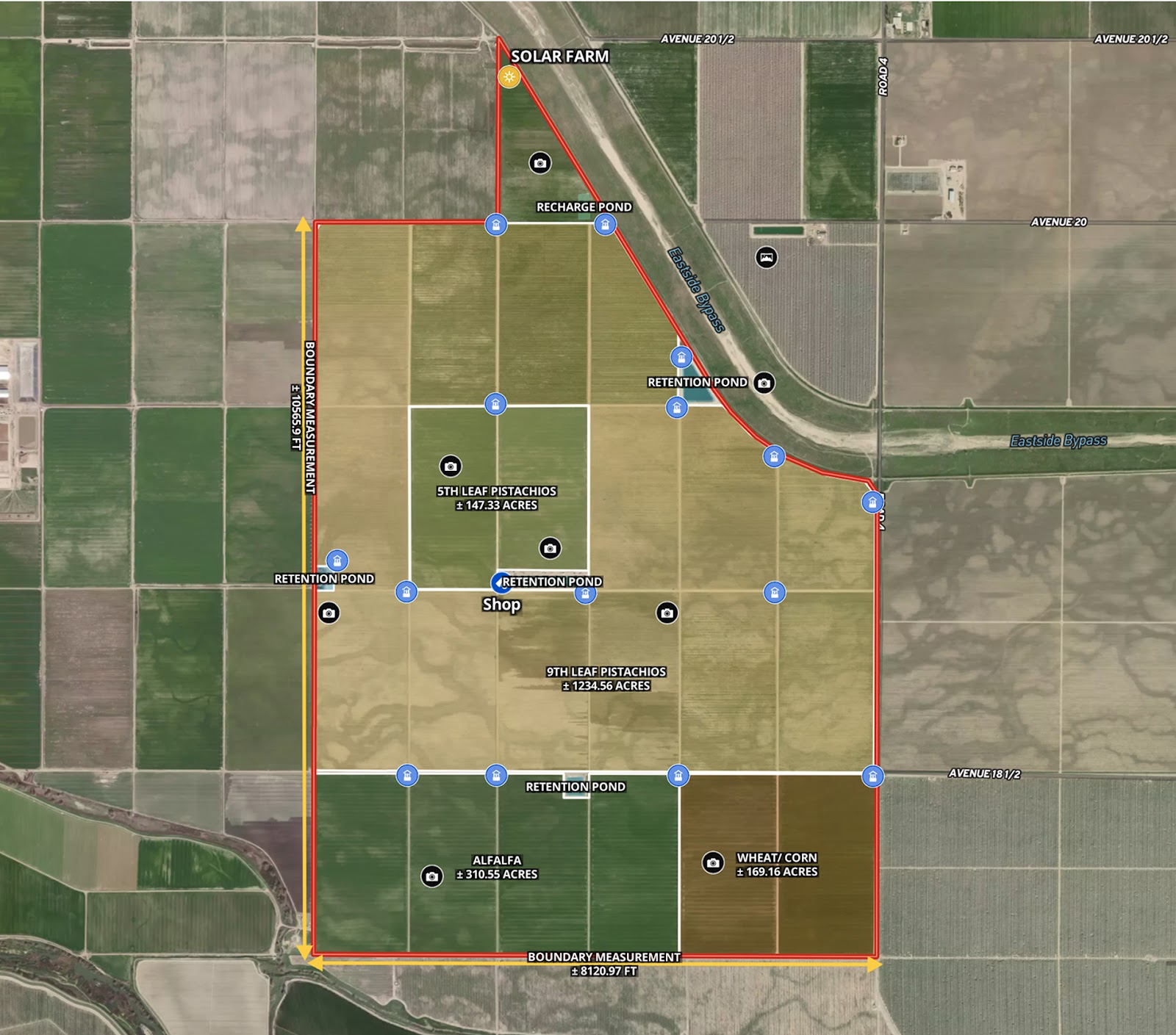
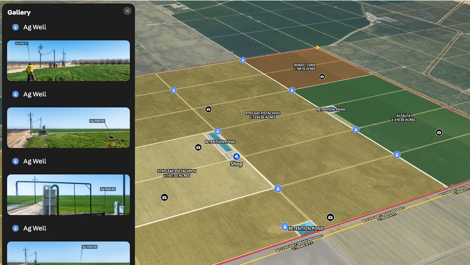
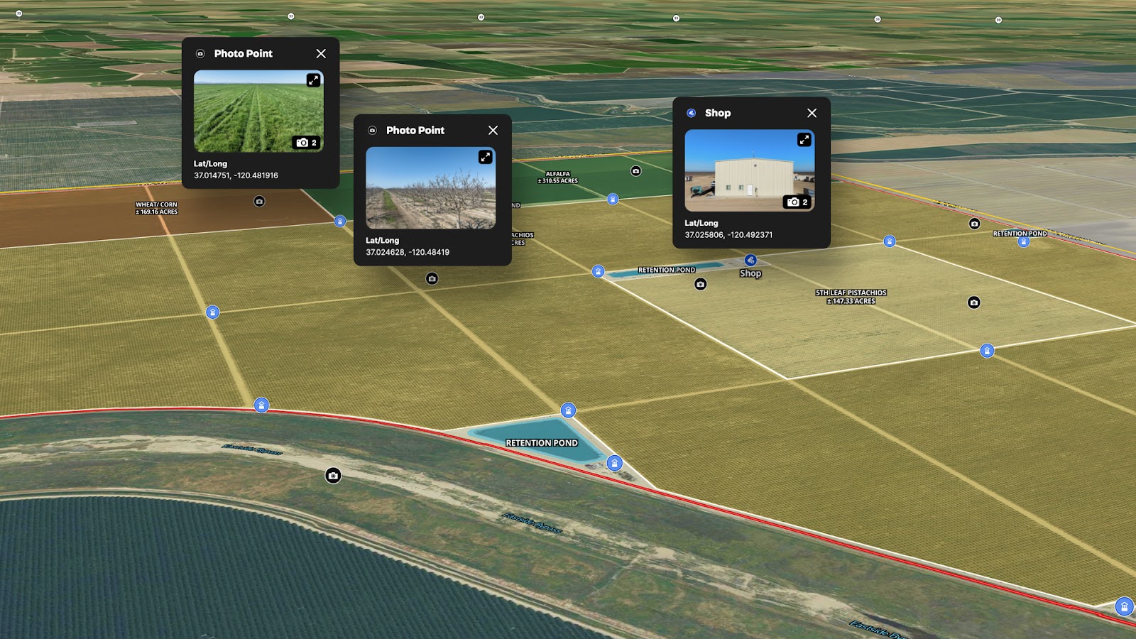
This particular map showcases an 1,800-acre agricultural farm in Madera County, California. The property features mature 5th and 9th leaf pistachios, along with rotational crops like alfalfa, wheat, and corn. Key improvements such as a shop and an on-site solar farm are also highlighted, giving potential buyers a clear and compelling picture of the property’s current value and long-term potential.
With Land id, Todd is helping agents make their listings more dynamic, more accessible, and ultimately more successful.
Learn How to Create a Map Like This:
- How to make maps in Land id
- Draw detailed maps by adding items
- Add labels to maps and mapped items
- Embed photos, videos, 360° walkthroughs, and more onto your map
- Add panoramic images
- Area measurement tool
Keep Exploring


5.6 Acre Rural Listing in Bozeman, MT

Commercial Real Estate Off-Market Prospecting

Subdivided Lots for Sale

Data Center Development Site Analysis
Take Your Mapping to the Next Level
Mapping is just the beginning. Land id is the #1 tool for researching, discovering, and showcasing land, and we're here to help you make the most of it, every step of the way.

